EarthByte Lab
Harnessing Geospatial Intelligence for a Sustainable PlanetData Science and Geospatial Intelligence for a Sustainable Planet
We help businesses, researchers, and policymakers make smarter, data-driven decisions using cutting-edge satellite data analytics, AI, and GIS solutions. Founded by Dr. Sasmita Sahoo, Ph.D. in Agriculture and Food Engineering, a leading scientist with 10+ years of experience in remote sensing, machine learning, and environmental modeling.We help businesses, researchers, and policymakers make smarter, data-driven decisions using cutting-edge data analytics, AI, and GIS solutions.
What We Do
We provide comprehensive data science and geospatial solutions that transform raw data into actionable insights for businesses, researchers, and policymakers worldwide.

📡 Geospatial Consulting
Custom GIS solutions for land management, precision agriculture, and environmental monitoring with Ph.D.-level expertise.
🛰️ Satellite Data Analytics
Advanced processing of Sentinel, Landsat, and SAR imagery using machine learning and cloud computing platforms.
☁️ Google Earth Engine (GEE) Development
Scalable, cloud-based geospatial workflows designed by a leading expert with extensive GEE experience.
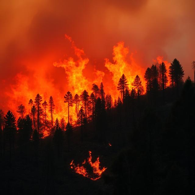
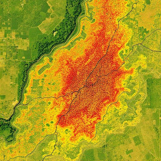
🔥 Wildfire and Climate Impact Assessments
Research-backed analysis of burn severity, drought patterns, and ecosystem changes using proven methodologies.
🤖 Machine Learning for Remote Sensing
AI-driven insights for land use classification, water resource management, and sustainability assessments.

🎓 Geospatial Education & Training
Professional training programs in GIS, remote sensing, and Earth observation taught by Dr. Sasmita Sahoo.
Technical Solutions
Cutting-edge methodologies and algorithms that push the boundaries of what's possible in digital agriculture, hydrology, and climate science.
Machine Learning for Hydrology & Agriculture
AI-driven solutions for groundwater modeling, crop monitoring, and agricultural optimization
Hybrid Artificial Neural Networks for Groundwater Prediction
Advanced neural network models optimized with genetic algorithms for predicting groundwater levels under climate change scenarios
Methodologies
- Multi-layer perceptron with Levenberg-Marquardt
- Genetic algorithm optimization
- Single spectrum analysis
- Mutual information theory
Performance
R² > 0.85 for 900,000+ monitoring wells
Scalability
Continental-scale implementation (450,000 km²)
Spectral Machine Learning for Plant Health Detection
Real-time classification of plant stress conditions using visible-near infrared spectroscopy and ML algorithms
Methodologies
- Weighted k-nearest neighbor
- Support vector machines
- Principal component analysis
- Ensemble classification
Performance
92.3% multi-class stress detection accuracy
Scalability
Smartphone-based field deployment
Integrated Crop-Water-Climate Modeling
Multi-scale modeling framework combining crop models, hydrological models, and climate projections
Methodologies
- Process-based crop modeling (DSSAT)
- Statistical downscaling
- Monte Carlo uncertainty analysis
- Ensemble forecasting
Performance
33-year calibration with climate observations
Scalability
Regional to national scale assessments
🔧 Technical Methodologies
Industry-leading practices and cutting-edge approaches
Machine Learning & AI
- Artificial Neural Networks (ANN) with genetic algorithm optimization
- Support Vector Machines and ensemble methods
- Principal Component Analysis and spectral feature extraction
- Weighted k-nearest neighbor and decision tree algorithms
Hydrological Modeling
- MODFLOW-based 3D groundwater flow simulation
- Time series analysis and statistical forecasting
- Monte Carlo uncertainty quantification
- Multi-objective optimization for resource management
Geospatial Analysis
- GIS-based multi-criteria decision analysis (MCDA)
- Remote sensing and satellite image processing
- Geostatistical modeling and spatial interpolation
- Self-organizing maps for pattern recognition
Ready to Implement Advanced Solutions?
Let's discuss how these cutting-edge methodologies can be adapted and applied to solve your specific challenges in agriculture, hydrology, or climate science.
Dr. Sasmita Sahoo
Agricultural engineer and founder of EarthByte Lab, dedicated to transforming data into actionable insights for sustainable agriculture and environmental solutions.

Areas of Expertise
Global Research Footprint
Our research spans multiple continents, addressing critical challenges in water resources, agriculture, and climate adaptation through cutting-edge geospatial analysis.
Study Locations
Research Categories
Research Locations
Central Valley, California
HydrologyUnited States
Large-scale groundwater modeling using machine learning algorithms for sustainable agricultural practices.
Active Studies:
- Groundwater level prediction
- Agricultural water management
Great Plains
AgricultureUnited States
Multi-state analysis of climate impacts on agricultural productivity using satellite data and ML models.
Active Studies:
- Crop yield forecasting
- Drought impact assessment
Murray-Darling Basin
HydrologyAustralia
Integrated hydrological modeling for water allocation and environmental flow requirements.
Active Studies:
- Water resource management
- Ecosystem modeling
Ganges-Brahmaputra Delta
Remote SensingBangladesh
SAR-based flood monitoring and early warning system development using advanced remote sensing techniques.
Active Studies:
- Flood prediction
- Land use change analysis
European Agricultural Regions
ClimateMultiple EU Countries
Cross-border collaboration on climate-smart agriculture using Earth observation data.
Active Studies:
- Climate adaptation strategies
- Precision agriculture
Impact & Case Studies
Real-world applications demonstrating measurable impact through rigorous scientific methodology and quantitative validation of our advanced solutions.
Machine Learning for Groundwater Management in U.S. Agricultural Regions
Center for Robust Decision Making on Climate and Energy Policy (RDCEP), University of Chicago
🎯 Challenge
Groundwater depletion in major agricultural regions posed significant risks to food security and economic sustainability. Traditional methods could not adequately predict future groundwater availability under changing climate and irrigation demands.
💡 Solution
Developed a hybrid artificial neural network (HANN) model integrating climate data, streamflow, and irrigation demand to predict groundwater level changes across 900,000 monitoring wells in agricultural regions.
🔬 Methodology
📈 Quantified Results
Additional Outcomes
Validation
Model validated against independent USGS groundwater observations and compared with traditional numerical models
Publication
Sahoo et al. (2017), Water Resources Research, doi: 10.1002/2016WR019933
Cumulative Impact Across All Projects
Our evidence-based approach ensures that every solution is rigorously tested, validated, and optimized for real-world impact and scalability.
Research Collaboration Portal
Join our global network of researchers, institutions, and organizations working together to advance the frontiers of digital agriculture, hydrology, and geospatial science.
Previous Affiliations
Penn State University
Michigan State University
How I Support Data Science Projects
Here's how we typically support data science projects across various domains:
Geospatial Data Integration
Integrating multisource satellite (Sentinel, Landsat, Planet), UAV, and climate datasets into actionable research pipelines.
Key Tools & Technologies:
Model Development
Co-developing models to monitor soil moisture, rangeland productivity, crop stress, and land use change using GEE, Python, and cloud platforms.
Key Tools & Technologies:
Proposal Writing & Grant Support
Partnering on proposal development and grant support for NSF, USDA, NASA, and climate-focused foundations.
Key Tools & Technologies:
Publication Support
Contributing to peer-reviewed research through geospatial analysis, data visualization, and methodological design.
Key Tools & Technologies:
Field + Satellite Fusion
Supporting projects that combine field trials or sensor data (e.g. Croptix, IoT) with remote sensing for validation and scaling.
Key Tools & Technologies:
Training & Capacity Building
Offering customized training sessions for collaborators on tools like GEE, QGIS, and cloud-based geospatial platforms.
Key Tools & Technologies:
Ready to Collaborate?
Let's work together on your next data science project. I specialize in geospatial analysis, remote sensing, and agricultural monitoring to help solve real-world challenges.
Why Work With Us?
We combine deep expertise with cutting-edge technology to deliver solutions that create real impact for your organization and the environment.
10+ years of expertise
Geospatial technology and environmental analytics.

Innovative solutions
Powered by AI, remote sensing, and cloud computing.

Impact-driven
Innovative approach for a sustainable, data-informed future.
Ready to Transform Your Data?
Whether you're working on challenges in agriculture, climate resilience, or environmental monitoring, we're here to help you harness the power of geospatial intelligence.
Let's Collaborate!
We help organizations transform geospatial data into meaningful impact. Whether through analytics, satellite-based monitoring or hands-on training, we're here to support your mission.
If you're working on challenges in agriculture, climate resilience or environmental monitoring, let's collaborate!